Where in the world would you find an island within a lake within an island within a lake
within an island? This particular geological oddity could be found in Taal volcano, which
a group of ALPers together with our honored balikbayans Imelda Joson and Edwin Aguirre set
out to visit one Sunday in November 26, 2006.
Our small group consisting of ALPers "Edwelda", James Kevin Ty, Allen Yu, Peter
Tubalinal, Dennis Llante and myself left Manila in a convoy of two vehicles at past 7:30
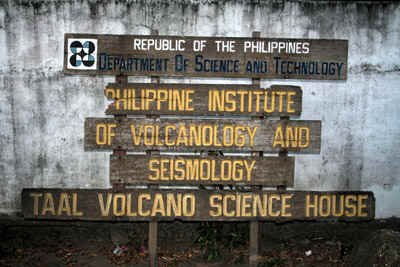
am for the Phivolcs Buco Station in Talisay City, Batangas. We had a stopover for
breakfast at the Alabang Shell gasoline station and were able to arrive at Tagaytay around
9 am. From Tagaytay ridge, we took the long zigzagging dirt road going down the Phivolcs
Buco station in Talisay, which took about an hour.
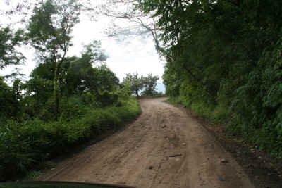 The long and winding road down to
Buco station |
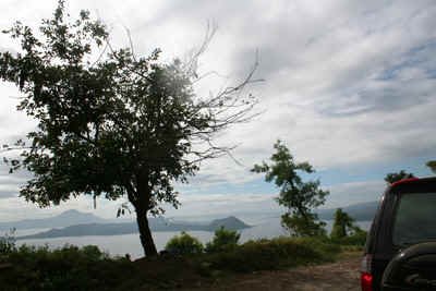 Approaching the shore of Lake
Taal
|
We reached Buco at about 10 am and Mr. Ric Seda, our guide was waiting for us at the
station with a boat. Buco station is at the Northwestern portion of Taal lake. After some
introductions and preliminaries, we wasted no time in loading our light gear and
provisions. We only brought our cameras and bottled water, soft drinks and some snacks so
that we would not be hampered so much with the trek going up the main crater.
 Source: Philvolcs |
 Source: Philvolcs |
 Philvolcs Buco Station - Talisay,
Batangas Philvolcs Buco Station - Talisay,
Batangas |
 All set to go ! |
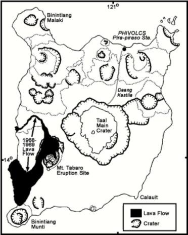
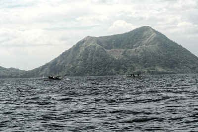
The boat ride from the Buco station to volcano island took
about 30 to 40 minutes and we had a nice view of Binintiang Malaki along the way. This
dormant volcanic vent is mistaken by most people as "The Taal Volcano" because
of its classic cone shape and ready visibility from the road along Tagaytay (not to
mention its ubiquitous appearance in textbook pictures, art works and postcards). The
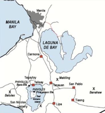
actual active volcano is Volcano island with its central crater lake. Volcano island is
actually just a part of what was once a very massive 6,000 meter high volcano which
erupted thousands of years ago forming a great depression which is now Taal Lake. Taal
Lake makes up most of the 25 x 30 km caldera formed by the collapse of this massive
prehistoric volcano, and Volcano Island represents the younger residual volcano in the
middle of the lake. Volcano Island has 47 identified cones and craters, and the last major
eruption here was in 1977. It is interesting to note that the Tagaytay high lands,
notwithstanding its skyrocketing real estate prices, is at the edge of the Taal caldera
and people who brought properties there may actually be living on an ancient volcano.
 Binintiang Malaki |
 Close-up of "Taal
Volcano" |
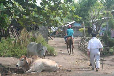
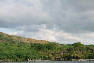
We reached the Northern shore of Volcano island just before 11 am. I was immediately
struck by the presence of a thriving community in this supposedly permanent volcanic
danger zone but I guess situations like this are normal in the Philippines. It is
estimated that about 5,000 people are living without permission on the 23 sq km Volcano
Island. In the event of an eruption, these people have to be evacuated posthaste using
only small boats like the one that we rode. This tourist-oriented community caters to the
foreign visitors (nowadays mostly South Korean) who flock to the island to view the main
crater. Most of the tourists make the ascent to the main crater riding on dwarf horses and
a big group of these horses with their handlers are waiting for potential riders just a
few meters from the shore (P 300 to rent a horse, guide included). Surgical masks were
also being sold by vendors since the trail is quite dusty especially if one is going by
foot.
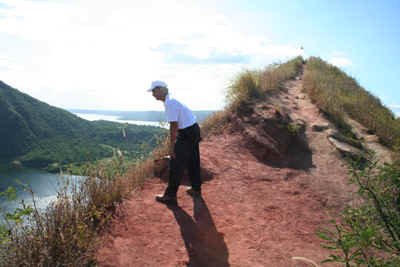
Our group proceeded right to the business of climbing up the main crater sans horses and
guide. We just followed the well-worn and dusty Daang Kastila, which is actually not a
very difficult trail to follow even for week-end climbers like us. What made the climb
uncomfortable was the hot morning sun and the dust, due mostly from the heavy traffic of
horses with their riders going both ways along the trail. At one instance, I was nearly
sideswiped by a horse being guided by a child-guide. For future climbers to Taal, I would
advice bringing the following items with them: a hat preferably with a cloth sun shade for
the neck area, sun block, sun glasses, surgical mask, bottled water and light snacks.
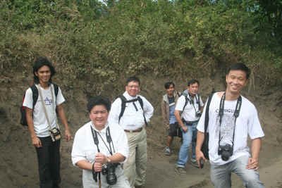
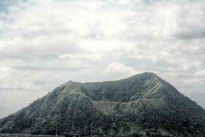
Our ascent was slow and leisurely and we made numerous rest stops along the way to take
pictures. Binintiang Malaki again made a good photo op since it was easily visible on our
right side.

|
Binintian Malaki as seen from Daang
Kastila trail. It forms the Northwestern appendage of Volcano Island. |
 Edwelda resting |
 ALP Boys |
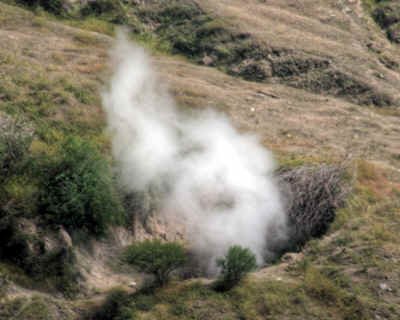
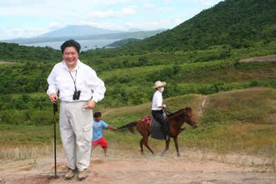
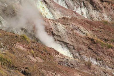
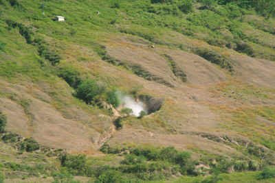
Near the summit, we encountered a steam vent along the trail. At first I thought that what
I saw was smoke coming from a fire along the trail but we were pleasantly surprised when
we found out that it was actually a volcanic steam vent. It smells mildly of rotten egg
(Hydrogen Sulfide) and the steam emanating from the hole is too hot to touch. While taking
pictures (and movies) of the steam vent, Dada pointed out a foreign tourist outrageously
dressed in a shirt and tie while riding up the slope. There was also another woman tourist
riding a horse who brought her small child with her. I can’t help being amazed about
the volume of tourists which I think is the normal situation here and Taal was even at
level 1 alert at the time!
 Volcanic steam vent near the
summit |
 Imelda and a tourist in short and
tie |
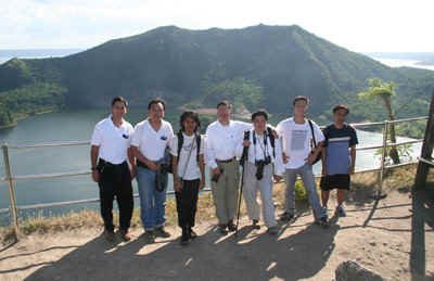
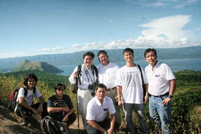
The last part of the climb was the steepest and most  difficult but we were all too excited about reaching the
summit to be bothered by it. I was previously joking with the group that there is a
Jollibee outlet at the top but what we actually found was very similar. There were
actually concrete steps leading up the viewing deck at the crater rim, and here are
enterprising vendors selling fresh buko (coconut), soft drinks, bottled water and even
beer! The buko juice was particularly refreshing and one can even eat the meat, making it
a complete meal at P 30 per coconut. After finishing our drinks and resting for a while,
we proceeded to take photos of the beautiful crater lake. difficult but we were all too excited about reaching the
summit to be bothered by it. I was previously joking with the group that there is a
Jollibee outlet at the top but what we actually found was very similar. There were
actually concrete steps leading up the viewing deck at the crater rim, and here are
enterprising vendors selling fresh buko (coconut), soft drinks, bottled water and even
beer! The buko juice was particularly refreshing and one can even eat the meat, making it
a complete meal at P 30 per coconut. After finishing our drinks and resting for a while,
we proceeded to take photos of the beautiful crater lake.
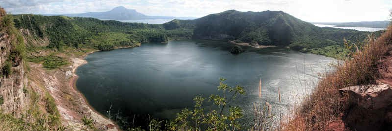
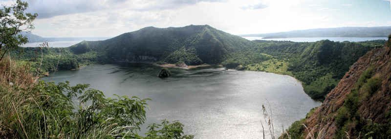 Crater Lake as seen from the
viewing deck . The lake is 2 km wide and 80 m deep. Crater Lake as seen from the
viewing deck . The lake is 2 km wide and 80 m deep. |

The island within a lake within an island within a lake
within an island |
From the viewing deck, I can smell the hydrogen sulfide
coming from several steam vents at the Northeastern edge of the crater lake. Part of the
lake’s water is bubbling due to steam and gas, and together with the multiple steam
vents indicate some heightened volcanic activity.
Another steam vent near the crater lake |
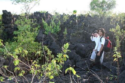
Our descent was much faster and easier and our guide, Mang Ric met us at the shore with
his boat. Our next destination was the lava fields at the Southwestern portion of the
island. Since it was already late in the afternoon we decided to forgo climbing Mt. Tabaro
and just visited the old lava flows from the 1969 eruption.
AT THE LAVA FIELD
We again rode our boat and we swung around Binintiang Malaki
towards the lava fields at the Southwestern portion of Volcano Island. Most of the lava
formations here were formed during the 1969 eruption of Mt. Tabaro.
 On the way to the lava fields |
 Old lava flows along the
southwestern shore of Volcano island |
At the Kaygabok shore of the lava fields, the vegetation was very dense but Mang Ric was
able to guide us to a marvelous lava rock formation where we were able to take rock
samples and pictures.
 Approaching the Kaygabok shore |
 Imelda and Dennis on top of a
lava rock formation |
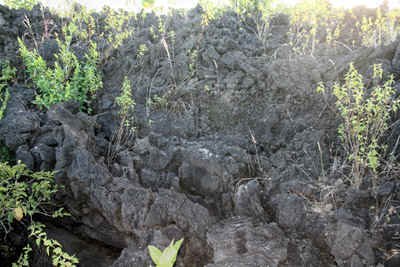 Close-up view of the old lava
rock formation |
 The source of the lava flow in
the background |
 Peter,
James, Allen and Dennis standing amidst lava deposits |
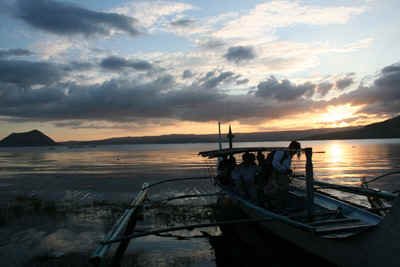 Sunset
signals the end of the ALP Taal expedition trip |
After that, we were just happy to get back to our boat and
start our way home. After a 30 min boat ride, we reached Buco station at sunset. This was
my first visit to Taal volcano and it was an immensely enjoyable (if not tiring) and
educational experience. I am very grateful to Dada and Edwin, if not for them I would not
have attempted my first ascent to Taal’s crater, something which I would heartily
recommend to all Filipinos to do at least once in their lives.
For more activity images of the event, click here. |


 Steam vents and bubbling water of
the crater lake
Steam vents and bubbling water of
the crater lake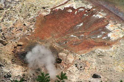
 Steam vent near a monitoring station